The Unprecedented Rise of Drones
Once relegated to the realm of military operations and niche hobbyists, drones, or Unmanned Aerial Vehicles (UAVs), have rapidly ascended to become one of the most transformative technologies of our era. Their evolution from rudimentary remote-controlled aircraft to sophisticated, intelligent machines capable of autonomous flight and complex tasks has been nothing short of revolutionary. We are witnessing a true “drone mania,” where these aerial marvels are reshaping industries, redefining leisure, and even influencing how we perceive the world from above. This comprehensive article delves deep into the multifaceted world of drones, exploring the core technological advancements that propel their capabilities, the diverse array of applications across various sectors, the profound societal impacts they generate, and the exciting trajectory of their future development. Prepare to embark on a journey that reveals how these flying robots are truly making the sky the limit.
What Makes Drones Fly and Function?
At their heart, drones are complex systems that integrate cutting-edge aerospace engineering, advanced electronics, and intelligent software. Understanding these foundational components is key to appreciating their versatility and potential.
A. Aerodynamics and Propulsion: Staying Aloft
The ability of a drone to fly depends fundamentally on its aerodynamic design and propulsion system.
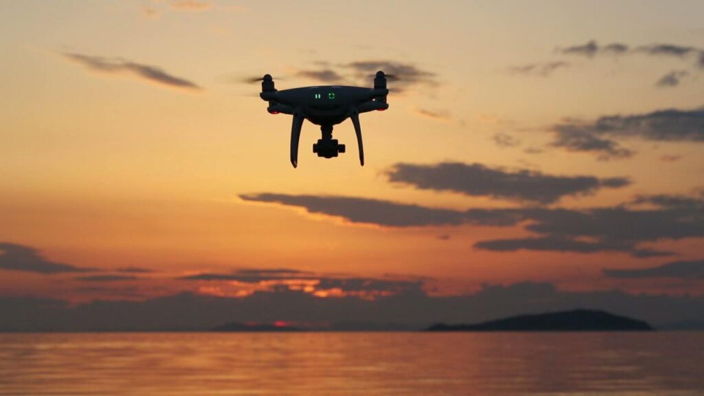
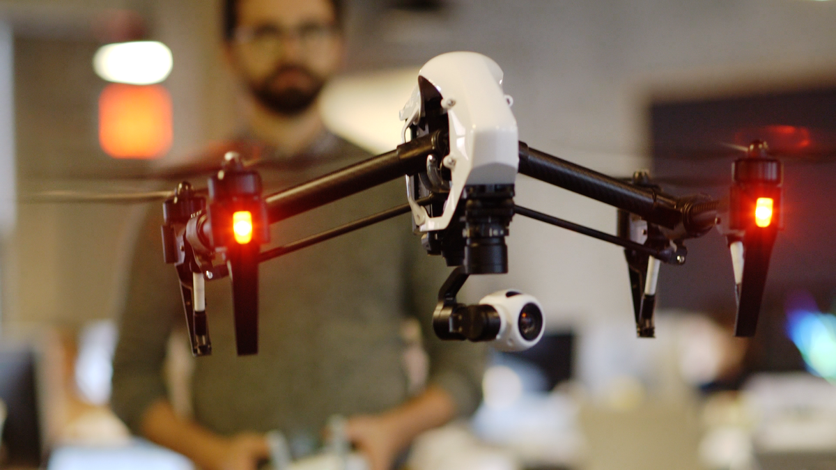
- Rotary-Wing Drones (Multirotors): The most common type for consumer and commercial use, multirotors (quadcopters, hexacopters, octocopters) use multiple propellers to generate lift and thrust. By independently controlling the speed of each propeller, the drone can achieve precise movements in all directions, including hovering, vertical takeoff and landing (VTOL), and intricate maneuvers. This design offers exceptional maneuverability and stability, making them ideal for tasks requiring precision, like aerial photography or inspection.
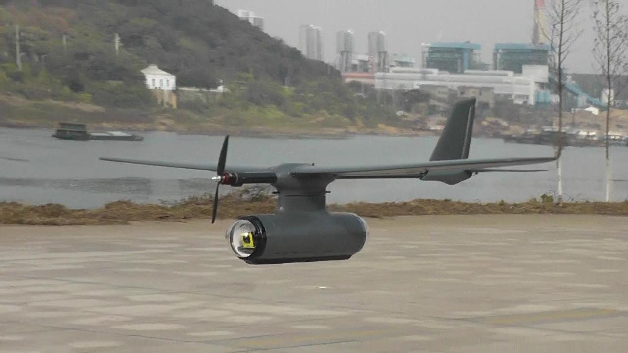
- Fixed-Wing Drones: Resembling traditional airplanes, fixed-wing drones use wings to generate lift from forward motion. They are typically more energy-efficient and can cover larger distances at higher speeds than multirotors, making them suitable for mapping large areas, long-range surveillance, or cargo delivery. They usually require a runway for takeoff and landing, though some advanced models incorporate VTOL capabilities.
- Hybrid Designs: Combining the best of both worlds, hybrid drones offer the VTOL capabilities of multirotors with the efficient forward flight of fixed-wing aircraft. This provides maximum flexibility for various missions, often seen in advanced commercial and military applications.
- Propulsion Systems: Most consumer and many commercial drones use electric motors powered by rechargeable lithium-polymer (LiPo) batteries. These offer clean, relatively quiet operation. Larger, more powerful drones for heavy-duty applications or longer endurance may use gasoline engines or even hydrogen fuel cells.
B. Flight Control Systems: The Brains of the Operation
The sophistication of a drone’s flight is managed by its highly advanced flight controller, essentially the drone’s brain.
- Inertial Measurement Units (IMUs): Comprising accelerometers and gyroscopes, IMUs detect the drone’s orientation, angular velocity, and linear acceleration. This data is crucial for maintaining stability and executing precise movements.
- Global Navigation Satellite Systems (GNSS): GPS (Global Positioning System) and other GNSS (like GLONASS, Galileo, BeiDou) modules provide the drone with accurate location data, enabling features like precise hovering, waypoint navigation, and automatic return-to-home.
- Barometers and Altimeters: These sensors measure atmospheric pressure to determine the drone’s altitude, allowing it to maintain a consistent height above the ground.
- Vision Positioning Systems (VPS) / Optical Flow: For indoor flight or areas where GPS signals are weak, VPS uses downward-facing cameras to track ground patterns, enabling precise hovering and navigation in confined spaces.
- Obstacle Avoidance Sensors: Many modern drones are equipped with forward, backward, downward, and even upward-facing sensors (optical, infrared, ultrasonic, LiDAR) that detect obstacles and automatically adjust the flight path to prevent collisions. This significantly enhances safety and enables more autonomous operations.
- Processor and Software: High-performance processors execute complex algorithms that integrate data from all sensors, interpret commands from the pilot, and manage motor speeds to maintain stable flight and perform programmed maneuvers. Firmware updates constantly enhance capabilities and introduce new features.
C. Communication Systems: The Link to Control
Reliable communication between the drone and its operator (or base station) is paramount.
- Radio Frequency (RF) Control: Traditional remote controllers use various radio frequencies (e.g., 2.4 GHz, 5.8 GHz) to send commands to the drone. Advanced systems use proprietary transmission technologies for longer ranges and reduced interference.
- Wi-Fi and Bluetooth: For shorter-range control, especially with consumer drones and direct smartphone connections, Wi-Fi and Bluetooth are often used for data transfer and video streaming.
- Cellular (4G/5G): Increasingly, commercial and enterprise drones are incorporating cellular modems for Beyond Visual Line of Sight (BVLOS) operations, allowing them to be controlled over vast distances wherever cellular coverage exists. 5G’s low latency and high bandwidth are particularly beneficial for real-time video feeds and critical command transmission.
- First-Person View (FPV) Systems: FPV drones transmit live video feeds from the drone’s camera to goggles worn by the pilot, providing an immersive, in-cockpit experience that is crucial for racing and acrobatic flying.
D. Payload Integration: The Purpose of Flight
Drones are not just about flying; they are platforms for carrying various payloads that enable them to perform their designated tasks.
- Cameras (Still and Video): High-resolution cameras, often stabilized by advanced gimbals, are the most common payload for aerial photography, videography, mapping, and surveillance. Specialized cameras include thermal, multispectral, and hyperspectral sensors for industrial and agricultural applications.
- Lidar (Light Detection and Ranging) Scanners: These sensors use laser pulses to create highly accurate 3D models of environments, invaluable for surveying, construction, and forestry.
- Delivery Mechanisms: Custom payloads can be designed to drop packages, deploy sensors, or even spray liquids for agricultural purposes.
- Communication Equipment: Drones can carry cellular repeaters or Wi-Fi hotspots to extend network coverage in remote areas or during emergencies.
- Gas Detectors and Environmental Sensors: For industrial inspections or environmental monitoring, drones can carry sensors to detect leaks, measure air quality, or identify hazardous materials.
The Sky’s Limit: Diverse Applications of Drones
The versatility of drones means their applications span an astonishing array of industries and activities, constantly expanding as technology advances and regulations evolve.
A. Aerial Photography and Videography: A New Perspective
This is perhaps the most visible and widely adopted use of drones, democratizing access to stunning aerial perspectives.
- Filmmaking and Television: Drones provide dynamic, cinematic shots that were once only achievable with expensive cranes or helicopters, revolutionizing visual storytelling in movies, TV shows, and commercials.
- Real Estate: High-quality aerial photos and videos showcase properties from unique angles, highlighting features and surrounding amenities, greatly enhancing marketing efforts.
- Events and Tourism: Drones capture breathtaking footage of concerts, festivals, weddings, and scenic landscapes, offering unparalleled visual documentation and promotion.
- Journalism and News Reporting: Drones provide a safe and quick way to capture aerial footage of breaking news events, protests, or natural disasters, offering crucial context and perspectives.
B. Surveying, Mapping, and Construction: Precision from Above
Drones are transforming how we manage and monitor large-scale projects, providing highly accurate data efficiently.
- Topographic Mapping and 3D Modeling: Drones equipped with photogrammetry or LiDAR sensors can quickly create highly detailed 2D maps and 3D models of terrain, construction sites, and infrastructure. This is invaluable for urban planning, land management, and geological surveys.
- Construction Progress Monitoring: Drones provide regular aerial updates on construction sites, allowing project managers to track progress, identify bottlenecks, and ensure safety compliance more effectively than traditional ground-based methods.
- Volume Calculation: By mapping quarries, stockpiles, or landfills, drones can accurately calculate material volumes, optimizing logistics and inventory management.
- Inspection of Infrastructure: Drones can inspect bridges, power lines, wind turbines, cell towers, and pipelines, reaching hazardous or hard-to-access areas safely and quickly, reducing costs and risks associated with human inspection.
C. Agriculture: Precision Farming and Crop Management
Drones are becoming indispensable tools for modern agriculture, enabling “precision farming” techniques.
- Crop Health Monitoring: Drones equipped with multispectral or thermal cameras can assess crop health, detect irrigation issues, identify pest infestations, and pinpoint nutrient deficiencies long before they are visible to the naked eye. This allows for targeted interventions, reducing pesticide and fertilizer use.
- Spraying and Seeding: Specialized drones can precisely spray pesticides, fertilizers, or even plant seeds, minimizing waste and ensuring uniform application across fields. This is particularly useful for difficult terrain or large areas.
- Livestock Monitoring: Drones can help farmers track and monitor livestock, locate lost animals, or even herd them efficiently.
- Irrigation Management: By mapping fields and analyzing plant health, drones can help farmers optimize irrigation schedules, conserving water.
D. Deliveries and Logistics: The Future of Supply Chains
The concept of drone delivery is moving from science fiction to a nascent reality, promising faster and more efficient last-mile logistics.
- Package Delivery: Companies like Amazon, Google Wing, and various startups are experimenting with drone delivery for small packages, particularly in rural or suburban areas. This could revolutionize e-commerce logistics, reducing delivery times and costs.
- Medical Supplies and Emergency Aid: Drones are proving invaluable for delivering critical medical supplies (e.g., blood, vaccines, organs) to remote or disaster-stricken areas quickly, overcoming geographical barriers.
- Inventory Management in Warehouses: Indoor drones equipped with cameras can autonomously scan barcodes and count inventory in large warehouses, significantly speeding up inventory checks and reducing human error.
E. Public Safety and Emergency Services: Saving Lives
Drones are becoming crucial assets for first responders, enhancing their capabilities in critical situations.
- Search and Rescue (SAR): Drones equipped with thermal cameras can rapidly search large areas for missing persons, particularly in challenging terrain or low-visibility conditions. Their aerial perspective can spot individuals or signs of life much faster than ground teams.
- Firefighting: Drones can provide firefighters with real-time aerial views of fire zones, identifying hotspots, assessing fire spread, and monitoring the safety of personnel, especially in large-scale wildfires or industrial fires.
- Law Enforcement: Police departments use drones for surveillance, traffic accident reconstruction, crowd monitoring, and even tracking suspects, providing valuable situational awareness while minimizing risk to officers.
- Disaster Response: After natural disasters like earthquakes or floods, drones can quickly assess damage, identify areas needing aid, and help coordinate relief efforts, often reaching areas inaccessible to ground vehicles.
F. Environmental Monitoring and Conservation: Guardians of the Planet
Drones offer a powerful new tool for environmental scientists and conservationists.
- Wildlife Monitoring and Anti-Poaching: Drones can track animal populations, monitor migration patterns, and detect poachers in remote wilderness areas, greatly assisting conservation efforts. Thermal cameras are particularly effective at night.
- Forestry and Reforestation: Drones can assess forest health, monitor deforestation, and even assist in reforestation efforts by precisely dropping seeds in designated areas.
- Pollution Monitoring: Drones equipped with specialized sensors can measure air and water quality, detect chemical spills, and monitor industrial emissions, providing critical data for environmental protection.
- Glacier and Coastal Erosion Monitoring: Drones can repeatedly map and photograph dynamic environments like glaciers and coastlines, providing valuable data to study climate change impacts.
G. Research and Development: Pushing Boundaries
Drones serve as versatile platforms for scientific research across numerous disciplines.
- Atmospheric Research: Drones can carry meteorological sensors into otherwise inaccessible parts of the atmosphere to study weather patterns, cloud formation, and atmospheric composition.
- Volcanology: Scientists use drones to collect gas samples from active volcanoes or map their interiors, reducing risks to human researchers.
- Oceanography: Specialized aquatic drones can monitor marine life, collect water samples, and map underwater terrain.
Navigating the Challenges: Societal Impact and Regulatory Frameworks
The rapid proliferation of drones brings with it a host of societal impacts and necessitates robust regulatory frameworks to ensure safety, privacy, and responsible use.
A. Privacy Concerns: The Eye in the Sky
The ability of drones to capture high-resolution imagery and video from above raises significant privacy concerns.
- Surveillance: The ease with which drones can conduct surveillance, whether by individuals, corporations, or governments, can infringe upon personal privacy in public and private spaces.
- Data Collection: Drones can collect vast amounts of data, including facial recognition data and license plate information, raising questions about data storage, security, and potential misuse.
- Regulation: Many countries are developing regulations to address drone privacy, often focusing on restrictions on flying over private property, mandates for data anonymization, and requirements for public notification of drone operations.
B. Safety and Security: Preventing Accidents and Malicious Use
Ensuring the safe operation of drones and mitigating potential security threats are paramount.
- Airspace Integration: Integrating drones into existing manned aircraft airspace safely is a complex challenge, requiring sophisticated air traffic management systems for UAVs (UTM – UAV Traffic Management).
- Collision Risk: The risk of collisions with manned aircraft, other drones, or ground objects necessitates robust obstacle avoidance systems and strict flight rules.
- Malicious Use: Drones can be misused for illegal activities such as smuggling, espionage, delivering contraband, or even as improvised weapons. Counter-drone technologies (e.g., jammers, net guns, laser systems) are being developed to mitigate these threats.
- Cybersecurity: Drones, like any connected device, are vulnerable to cyberattacks, including hijacking, data theft, or denial-of-service attacks. Secure communication protocols and robust software are essential.
C. Regulatory Landscape: A Patchwork of Rules
Drone regulations vary significantly from country to country and even within regions, creating a complex operating environment.
- Licensing and Certification: Many jurisdictions require drone operators to be licensed or certified, particularly for commercial operations.
- Flight Restrictions: Rules often dictate maximum flight altitude, restrictions over sensitive areas (airports, critical infrastructure, public gatherings), and limitations on Beyond Visual Line of Sight (BVLOS) operations.
- Registration: Drones often need to be registered with aviation authorities, linking the drone to its owner for accountability.
- Future Trends: Regulators are working towards more harmonized international standards, streamlined approval processes for BVLOS operations, and implementing Remote ID technologies (allowing authorities to identify drones in flight).
D. Public Perception and Acceptance
Public acceptance of drones is crucial for their widespread adoption. While many appreciate the benefits, concerns about noise, privacy, and safety can lead to opposition. Transparent communication about drone uses, adherence to regulations, and demonstration of positive societal impact are key to fostering public trust.
Future Trends in Drone Technology
The pace of innovation in drone technology shows no signs of slowing down. Several exciting trends are poised to shape the next generation of aerial robotics.
A. Increased Autonomy and AI Integration
Future drones will be even more autonomous, relying heavily on advanced AI for decision-making and mission execution.
- Swarm Robotics: The ability for multiple drones to operate collaboratively as a single intelligent unit, performing complex tasks in unison. This has applications in large-scale mapping, disaster response, and synchronized light shows.
- Self-Healing and Adaptive Systems: Drones that can detect and compensate for minor hardware failures or adapt to changing environmental conditions (e.g., strong winds) in real-time.
- AI for Navigation in GPS-Denied Environments: Advanced AI algorithms, combining vision-based navigation (SLAM – Simultaneous Localization and Mapping) with other sensors, will enable highly reliable autonomous flight in complex indoor environments or underground.
B. Enhanced Battery Life and Alternative Power Sources
Longer flight times are a constant pursuit.
- More Efficient Batteries: Continued improvements in lithium-ion and next-generation battery chemistries (e.g., solid-state batteries) will lead to significant gains in energy density, translating to longer endurance.
- Hydrogen Fuel Cells: For very long endurance applications, hydrogen fuel cells offer dramatically longer flight times than batteries, with water as the only byproduct.
- Solar-Powered Drones: High-altitude, long-endurance (HALE) drones incorporating solar panels can stay aloft for days or even months, acting as atmospheric satellites for communication or surveillance.
C. Counter-Drone Technologies and Geofencing
As drones become more prevalent, so too will the need for sophisticated countermeasures against misuse.
- Advanced Geofencing: More intelligent geofencing systems will automatically prevent drones from entering restricted airspace based on real-time data and regulatory zones.
- Drone Detection Systems: Technologies like radar, acoustic sensors, and RF scanners will become more widespread for identifying and tracking unauthorized drones.
- Sophisticated Countermeasures: From non-kinetic options like jamming and spoofing to kinetic solutions like net guns or even specialized “interceptor drones,” counter-drone capabilities will continue to evolve.
D. Urban Air Mobility (UAM) and Passenger Drones
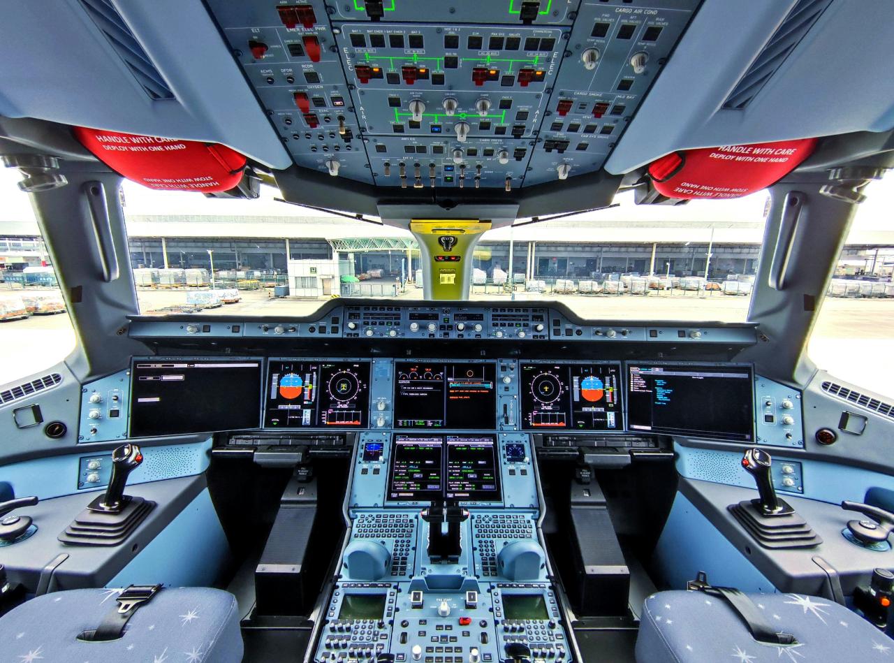
The ultimate vision for many drone innovators is Urban Air Mobility (UAM), involving autonomous or semi-autonomous passenger-carrying drones (often called “air taxis” or “eVTOLs” – electric Vertical Takeoff and Landing aircraft). While facing significant regulatory, safety, and infrastructure challenges, UAM promises to revolutionize intra-city travel, offering a new dimension of transportation.
E. Miniaturization and Micro-Drones
Ongoing advancements in materials science and microelectronics will lead to even smaller and more discreet drones, opening up new possibilities for indoor inspection, surveillance in confined spaces, and biological research.
Conclusion
The phenomenon of “drone mania” is far more than a passing fad; it represents a fundamental shift in our capabilities to perceive, interact with, and operate within the aerial domain. From transforming industrial operations and agricultural practices to enhancing public safety and revolutionizing logistics, drones are proving to be indispensable tools across an ever-widening spectrum of applications. They are pushing the boundaries of what’s possible, offering unprecedented perspectives and efficiencies that were unimaginable just a few decades ago.
However, the rapid ascent of drones also underscores the critical need for thoughtful governance, robust safety protocols, and a clear ethical compass. As these intelligent aerial robots become increasingly autonomous and integrated into our daily lives, addressing concerns around privacy, security, and public acceptance will be paramount. The journey of drone technology is a compelling narrative of human ingenuity and ambition. With continued innovation and responsible deployment, drones are poised to unlock even greater potential, ensuring that the sky truly is not the limit, but merely the beginning of their extraordinary flight.


